St Johannes Feste
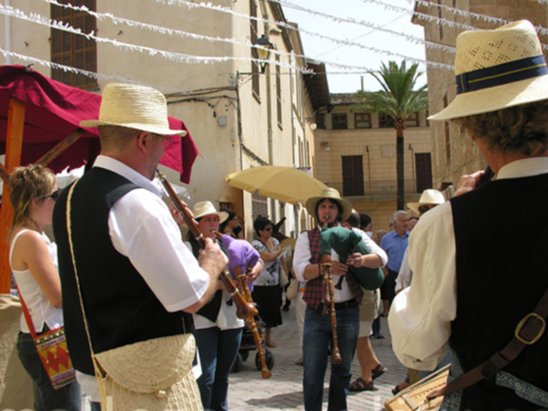
24 Juni Son Servera Es sind die Feierlichkeiten zur Kirchweih von Son Servera und findet schon fast seit einem Jahrhundert statt. Die Kirche von Sant
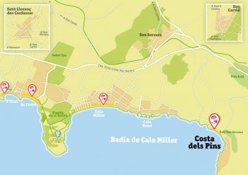
Wie der Name andeutet, liegt die Costa dels Pins an einem Berghang, einem Teil der Serra de Llevant der Insel, die von Artà bis Felanitx in einer diskontinuierlichen Bergkette verläuft und sechshundert Meter nicht überschreitet. Der dahinter liegende Berg schützt vor dem Nordwind und trennt sie von Canyamel, das zur Gemeinde Capdepera gehört.
Die Costa dels Pins verläuft mit vielen Buchten ins Meer, die bekannteste ist Sa Marjal und Es Rajolí, ideal für diejenigen, die ruhige Strände und zum Schnorcheln suchen, um die friedliche Meeresfauna unserer Küsten kennenzulernen. Ein Ort, der gut von Touristen besucht wird, ist der Aussichtspunkt des Cap des Pinar, im Norden der Costa dels Pins, mit spektakulärem Blick auf die Bucht von Cala Millor. Es gibt auch Wanderwege, die die Costa dels Pins mit Canyamel verbinden.
Die Costa dels Pins ist berühmt für ihre Architektur und ist in erster Linie ein Wohngebiet mit Luxus-Immobilien. In der Tat verbringen hier viele bekannte Künstlern und Wirtschaftsmagnaten ihren Sommer. Es gibt ein kleines Einkaufszentrum mit ein paar Läden und Restaurants, ein emblematisches Hotel, einen 18-Loch-Golfplatz und eine unschlagbare Landschaft, die sie genießen können. Das kleine Einkaufszentrum liegt im Norden des Hauptstrandes und kann zu Fuß, mit dem öffentlichen Bus oder dem touristischen Mini-Zug erreicht werden.

24 Juni Son Servera Es sind die Feierlichkeiten zur Kirchweih von Son Servera und findet schon fast seit einem Jahrhundert statt. Die Kirche von Sant

Februar Die Firó de la Flor d’Ametler (Mandelblütenfest) ist eine Messe traditionellen Charakters, deren Zweck es ist, mit der Mandel, der Landwirtschaft und der verarbeitenden
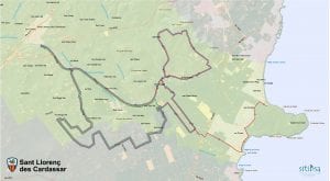
Sant Llorenç. Entfernung 15-40 km. Schwierigkeit 3/4. Die Route, von der Radsportlerin Marga Fullana entworfen, führt durch die Gemeinde von Sant Llorenç des Cardassar. Die
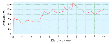
Länge 10.08 Km. Dauer 180 min. Steigung 164 m. Einweg-Strecke Wikiloc map Der Ausgangspunkt dieser Wanderung, einer Teilstrecke des Wanderwegs GR-222, ist der Hauptplatz von
Com el seu nom bé indica, la Costa dels Pins se situa en un vessant muntanyós que forma part de la serra de Llevant de l’illa i que recorr des de la comarca d’Artà fins a Felanitx en una serralada discontínua i amb altures que mai no sobrepassen els sis-cents metres. La muntanya que s’alça darrere el protegeix del vent del nord i el separa del nucli de Canyamel, pertanyent al municipi de Capedepera.
La Costa dels Pins s’endinsa al mar amb multitud de cales, les més conegudes les de sa Marjal i es Rajolí, perfectes per als qui cerquen platges tranquil·les i ideals per bussejar i conèixer la pacífica fauna marina de les nostres costes. Un lloc molt visitat pels turistes és el mirador del cap des Pinar, al nord de la Costa dels Pins, amb unes espectaculars vistes de tota la badia de Cala Millor. També hi ha rutes de senderisme per muntanya que enllacen la Costa dels Pins amb Canyamel.
La Costa dels Pins és famosa per la seva arquitectura i és principalment una zona residencial de cases de luxe; de fet, compta entre els seus residents amb multitud d’artistes coneguts i magnats dels negocis que han decidit ubicar la seva residència estiuenca en aquesta costa. Té un petit centre comercial d’un parell de botigues i restaurants, un hotel emblemàtic, un camp de golf de 18 forats i gaudeix, a més, d’un entorn paisatgístic immillorable. El petit centre comercial es troba al nord de la platja principal i s’hi pot arribar caminant, en autobús públic o minitren turístic.


Variable Termine im Februar oder März Dieses Fest wird in der Woche vor dem Beginn der Fastenwoche begangen, was 40 Tage vor Ostern ist und
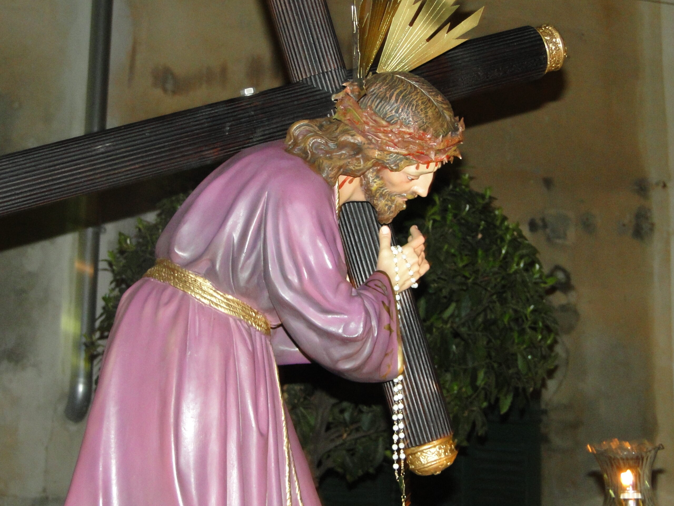
März / April Verschiedene liturgische Handlungen und Prozessionen finden von Palmsonntag bis Ostersonntag statt. Am bekanntesten sind die Feierlichkeiten am Gründonnerstag, Karfreitag, Ostersonntag oder Sonntag
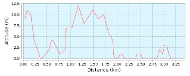
Länge 3,28 Km. Dauer 60 min. Steigung 1 m. Einweg-Strecke Wikiloc map Von Ausgangspunkt wandern wir entlang des Radwegs Richtung Costa dels Pins.
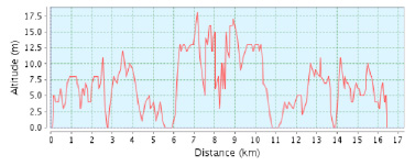
Länge 16.64 Km. Route Cala Millor – Cala Bona – Costa dels Pins – Cap des Pinar – Cala Millor Wikiloc Map Vom Ausgangspunkt folgen
As its name suggests, the Costa dels Pins (Pine Tree Coast) is on a slope running down to the sea from the island’s Llevant Mountains. These mountains run from the county of Artà to Felanitx in a discontinuous chain that never rises above six hundred metres. The mountain behind the resort protects it from the north winds and separates it from the town of Canyamel in the municipality of Capdepera.
The Costa dels Pins juts into the sea and has a multitude of coves, the best known of which are Sa Marjal and Es Rajolí. They are perfect for those looking for a quiet beach and ideal for snorkelling and diving to see the marine fauna of our coast. A very popular spot with visitors is the Cap des Pinar lookout point, to the north of the Costa dels Pins, with its spectacular views over the whole of Cala Millor bay. There are also attractive hiking routes that link the Costa dels Pins with Canyamel.
The Costa dels Pins is mainly a residential zone with many luxurious houses and is famous for its architecture. Its residents include a large number of well known artists and captains of industry who have chosen this area for their summer residences. It has a small shopping centre with a couple of shops and restaurants, an emblematic hotel, an 18-hole golf course and, of course, unbeatable scenery. The small shopping centre is to the north of the main beach and can be reached on foot, by public bus or on the mini tourist train.


24 Juni Son Servera Es sind die Feierlichkeiten zur Kirchweih von Son Servera und findet schon fast seit einem Jahrhundert statt. Die Kirche von Sant

Februar Die Firó de la Flor d’Ametler (Mandelblütenfest) ist eine Messe traditionellen Charakters, deren Zweck es ist, mit der Mandel, der Landwirtschaft und der verarbeitenden
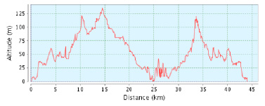
Länge 43.95 Km. Schwierigkeit 3/4 Route Cala Millor – Son Servera – Artà – Canyamel Son Servera – Cala Millor Wikiloc map Vom Ausgangspunkt radeln
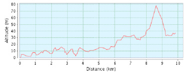
Länge 16.64 Km. Route Cala Millor – Sa Coma – S‘Illot – Son Carrió – Cala Millor Vom Ausgangspunkt folgen wir der Beschilderung Richtung Zentrum
Como su nombre indica, la Costa de los Pinos se sitúa en una ladera montañosa que forma parte de la sierra de Levante de la isla, que recorre desde la comarca de Artà hasta Felanitx en una cordillera discontinua y con alturas que nunca sobrepasan los seiscientos metros. La montaña que se alza detrás le protege del viento del norte y le separa del núcleo de Canyamel, perteneciente al municipio de Capdepera.
La Costa de los Pinos se adentra en el mar con multitud de calas, las más conocidas sa Marjal i es Ratjolí, perfectas para quienes buscan playas tranquilas e ideales para bucear y conocer la pacífica fauna marina de nuestras costas. Un lugar muy visitado por los turistas es el mirador des Cap des Pinar, al norte de la Costa de los Pinos, con unas espectaculares vistas de toda la bahía de Cala Millor. También hay rutas de senderismo por montaña que enlazan la Costa de los Pinos con Canyamel.
La Costa de los Pinos es famosa por su arquitectura y es principalmente una zona residencial de casas de lujo; de hecho cuenta entre sus residentes con multitud de artistas conocidos y magnates de los negocios que han decidido ubicar su residencia veraniega en esta costa. Tiene un pequeño centro comercial de un par de tiendas y restaurantes, un hotel emblemático, un campo de golf de 18 hoyos y disfruta además de un entorno paisajístico inmejorable. El pequeño centro comercial se encuentra al norte de la playa principal y se puede llegar andando, en bus público o minitren turístico.
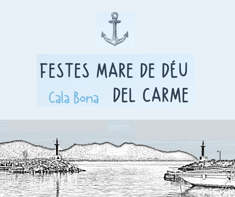
Mitte Juli Wie es traditionell ist, feiern die Seeleute von Cala Bona jeden 16. Juli das Fest ihres Schutzpatrons. Die feierliche Messe wird gefeiert und

Im diesen Jahre 2023 wird das Touristenfest von 15 September bis 1.Oktober , ein paar Wochen voller Veranstaltungen, die von den beiden Gemeinden der Destination

Länge 3,28 Km. Dauer 60 min. Steigung 1 m. Einweg-Strecke Wikiloc map Von Ausgangspunkt wandern wir entlang des Radwegs Richtung Costa dels Pins.

Länge 16.64 Km. Route Cala Millor – Sa Coma – S‘Illot – Son Carrió – Cala Millor Vom Ausgangspunkt folgen wir der Beschilderung Richtung Zentrum
© Consorci de Turisme de Son Servera i Sant Llorenç des Cardassar
This website uses cookies so that we can provide you with the best user experience possible. Cookie information is stored in your browser and performs functions such as recognising you when you return to our website and helping our team to understand which sections of the website you find most interesting and useful.
Strictly Necessary Cookie should be enabled at all times so that we can save your preferences for cookie settings.
If you disable this cookie, we will not be able to save your preferences. This means that every time you visit this website you will need to enable or disable cookies again.