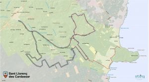
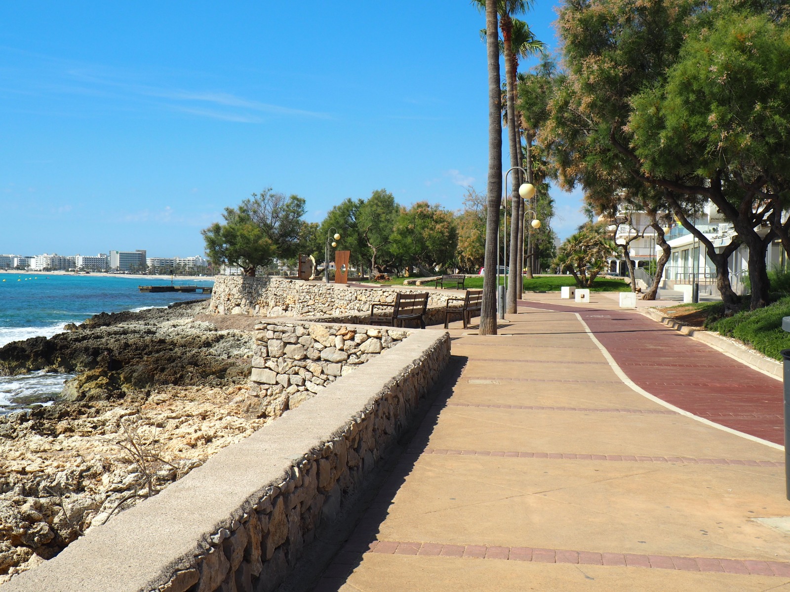
Hiking route Cala Bona Canyamel
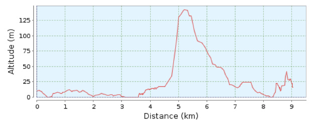
Distance 9.6 Km. Duration 150 min. Ascending slope 250 m. Difficulty 3/4 Type no circular From Cala Bona Tourist Information Office follow the cycle track
Distance 9.6 Km. Duration 150 min. Ascending slope 250 m. Difficulty 3/4 Type no circular From Cala Bona Tourist Information Office follow the cycle track
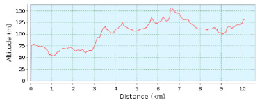
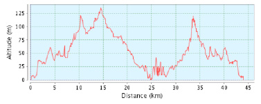
Distance 10.08 Km. Duration 180 min. Ascending slope 164 m. Type no circular Wikiloc map The beginning of this section of the GR-222 is the
Distance: approx. 8.80 km
Approximate time: 2 h.
Accumulated ascent: 23
Accumulated descent: 23
Difficulty: Low
Type of itinerary: Circular
Start: Cala Millor Tourist Information Office. Av. Badia de Llevant, 2
End: Son Carrió
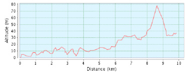
Distance: 9.82 km
Approximate time: 2 h 30 min
Accumulated ascent: 78 m
Accumulated descent: 45 m
Difficulty: Low
Type of itinerary: Non-circular
Start: Cala Bona Tourist Information Office
End: Platja Sa Marjal (Costa dels Pins)
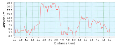
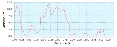
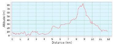
Distance covered: 3.28 km
Approximate time: 1 hour
Accumulated ascent: 1 m
Accumulated descent: 8 m
Difficulty: Low
Type of route: Non-circular
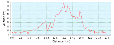
Start: Cala Millor information office. Av Badia de Llevant, 2. End: Cala Millor information office. Av Badia de Llevant, 2. Distance: 27.26 Km Difficulty: Low
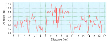
Distance 16.64 Km. Ittinerary Cala Millor – Cala Bona – Costa dels Pins – Cap des Pinar – Cala Millor Wikiloc Map From the
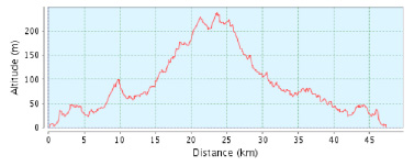
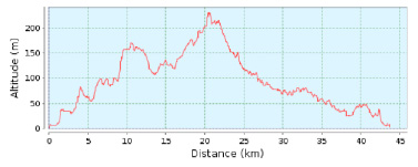
Distance 47,30 Km. Difficulty 2/4 Itinerary Cala Millor – Son Carrió – Sant Llorenç – Volta per Infern – Sant Llorenç – Son Carrió –
Distance 16.64 Km. Itinerary Cala Millor – Sa Coma – S‘Illot – Son Carrió– Cala Millor Wikiloc map From the starting point follow the signs
Sant Llorenç. Distance 15-40 km. Dificultad 3/4. Designed by the champion cyclist Marga Fullana, the route follows roads in the municipality of Sant Llorenç des
Distance 11.85 Km. Ittinerary Cala Millor – Port Vell – Son Servera – Cala Millor Wikiloc Map From the starting point follow the cycle lane
Distance 43.72 Km
Difficultty Medium
Itinerary Cala Millor-Son Servera-Artà-Sant Llorenç-Cala Millor
Distance 28.53 Km The proximity of Cala Millor, as well as Sa Coma and Cala Bona, make it a good choice for visiting these inland
In addition to sun and beaches, Cala Millor offers its visitors many other leisure and entertainment activities. Its 20 kilometres of fairly flat terrain make
Distance 43.95 Km. Difficulty 3/4 Itinerary Cala Millor – Son Servera – Artà – Canyamel Son Servera – Cala Millor Wikiloc map From the starting