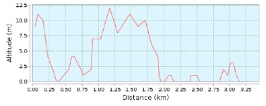
Küstenroute
Länge 3,28 Km. Dauer 60 min. Steigung 1 m. Einweg-Strecke Wikiloc map Von Ausgangspunkt wandern wir entlang des Radwegs Richtung Costa dels Pins.
Das milde Klima mit angenehmen Temperaturen, die uns das ganze Jahr über begleiten, dazu die wunderschönen Berglandschaften und das ruhige Mittelmeer machen sie zu einem Outdoor-Aktivitäten idealen Ziel.

Länge 3,28 Km. Dauer 60 min. Steigung 1 m. Einweg-Strecke Wikiloc map Von Ausgangspunkt wandern wir entlang des Radwegs Richtung Costa dels Pins.
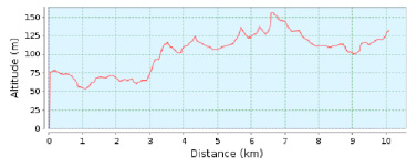
Länge 10.08 Km. Dauer 180 min. Steigung 164 m. Einweg-Strecke Wikiloc map Der Ausgangspunkt dieser Wanderung, einer Teilstrecke des Wanderwegs GR-222, ist der Hauptplatz von
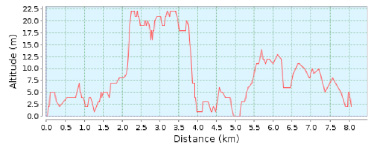
Länge: 8,8 km
Dauer: ca. 2 Stunden
Gesamtanstieg: 23 m
Gesamtabstieg: 23 m
Schwierigkeitsgrad: niedrig
Art der Route: Rundstrecke
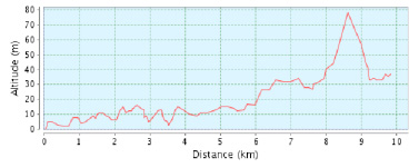
Länge: 9,82 km
Dauer: ca. 2 Stunden 30 min
Gesamtanstieg: 78 m
Gesamtabstieg: 45 m
Schwierigkeitsgrad: niedrig
Art der Route: Einweg-Strecke
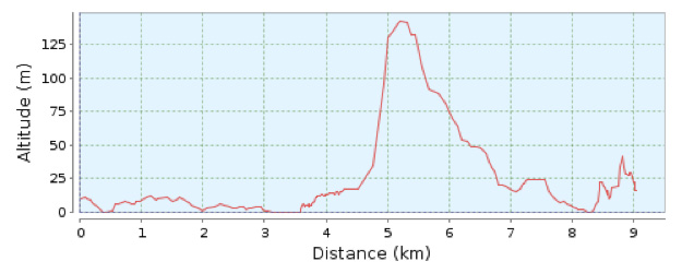
Länge 9.6 Km. Dauer 150 min. Steigung 250 m. Schwierigkeit 3/4 Einweg-Strecke Vom Fremdenverkehrsbüro von Cala Bona wandern wir entlang des Radwegs Richtung Costa dels

Länge 16.64 Km. Route Cala Millor – Sa Coma – S‘Illot – Son Carrió – Cala Millor Vom Ausgangspunkt folgen wir der Beschilderung Richtung Zentrum
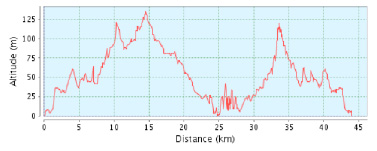
Länge 43.95 Km. Schwierigkeit 3/4 Route Cala Millor – Son Servera – Artà – Canyamel Son Servera – Cala Millor Wikiloc map Vom Ausgangspunkt radeln
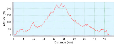
Entfernung 47,30 Km.
Schwierigkeit 2/4
Reiseroutei Cala Millor – Son Carrió – Sant Llorenç – Volta per Infern – Sant Llorenç – Son Carrió – Cala Millor.
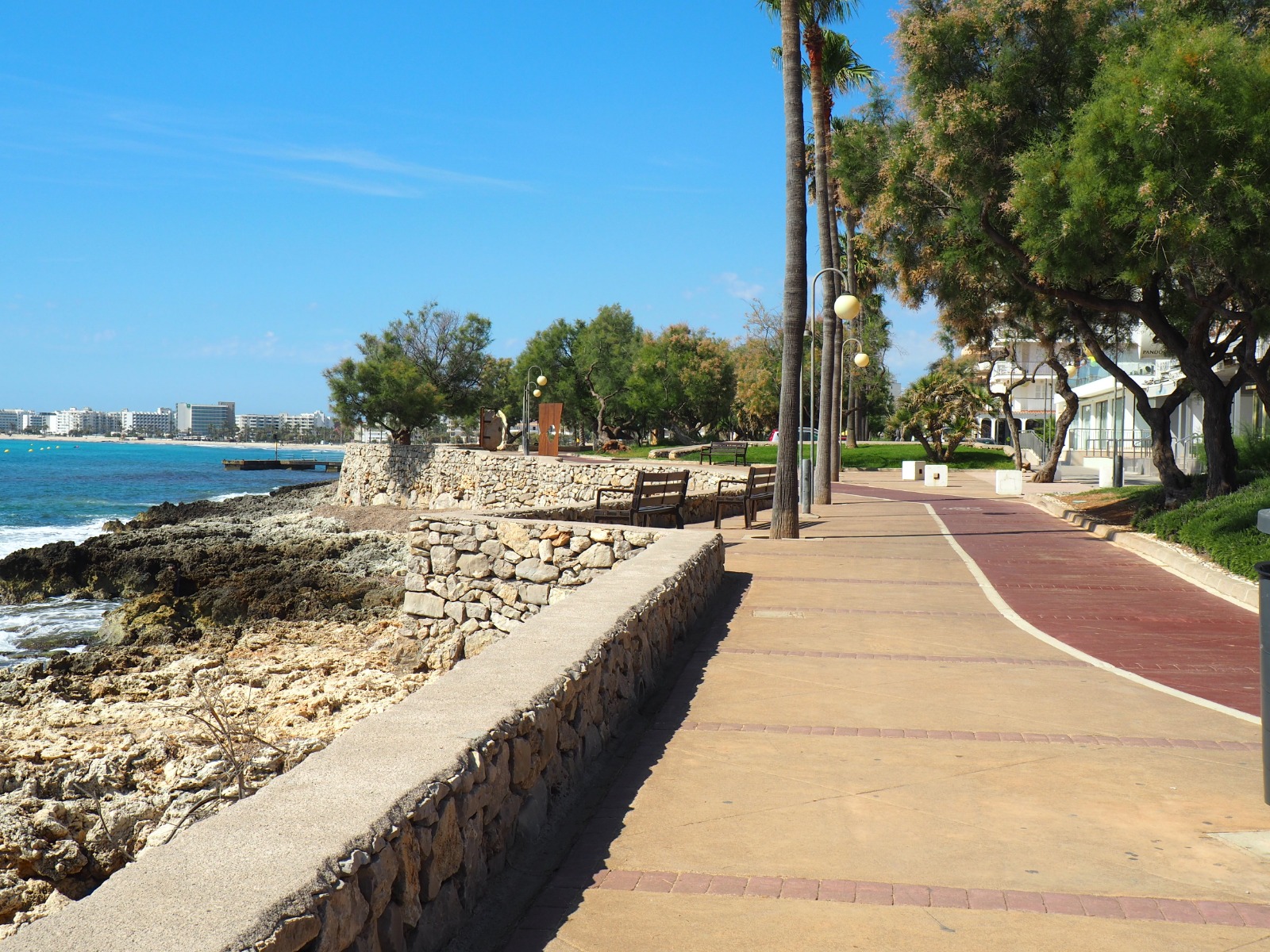
Neben Sonne und Strand bietet Cala Millor seinen Besuchern unzählige Möglichkeiten der Freizeitgestaltung. Die 20 km lange, flache und sichere Bucht ist ideal für Ausflüge
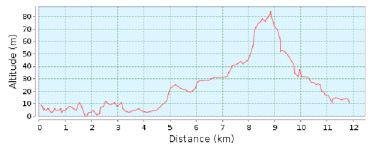
Länge 11.85 Km. Route Cala Millor – Port Vell – Son Servera – Cala Millor Wikiloc Map Vom Ausgangspunkt folgen wir dem Radweg, der entlang
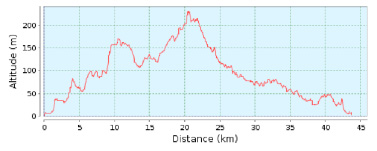
Entfernung 43.72 Km
Schwierigkeit Mittel
Reiseroute Cala Millor-Son Servera-Artà-Sant Llorenç-Cala Millor
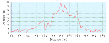
Länge 27.26 Km. Route Cala Millor – Sa Coma – S’illot – Cala Morlanda – Porto Cristo – Camí de sa Marineta – Son Carrió
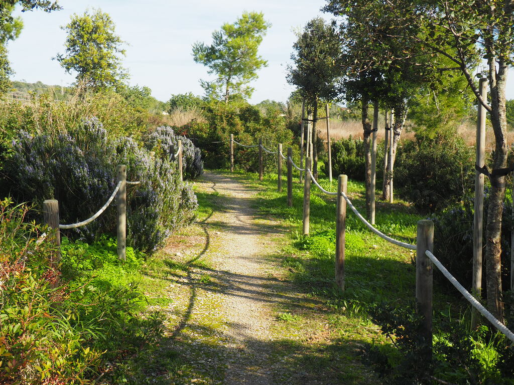
Länge: 28.53 Km Die Nähe zu Cala Millor, sowie zu Sa Coma und Cala Bona machen die Strecke zur idealen Wahl, wenn man weit ab
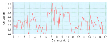
Länge 16.64 Km. Route Cala Millor – Cala Bona – Costa dels Pins – Cap des Pinar – Cala Millor Wikiloc Map Vom Ausgangspunkt folgen
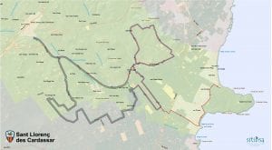
Sant Llorenç. Entfernung 15-40 km. Schwierigkeit 3/4. Die Route, von der Radsportlerin Marga Fullana entworfen, führt durch die Gemeinde von Sant Llorenç des Cardassar. Die
© Consorci de Turisme de Son Servera i Sant Llorenç des Cardassar
This website uses cookies so that we can provide you with the best user experience possible. Cookie information is stored in your browser and performs functions such as recognising you when you return to our website and helping our team to understand which sections of the website you find most interesting and useful.
Strictly Necessary Cookie should be enabled at all times so that we can save your preferences for cookie settings.
If you disable this cookie, we will not be able to save your preferences. This means that every time you visit this website you will need to enable or disable cookies again.